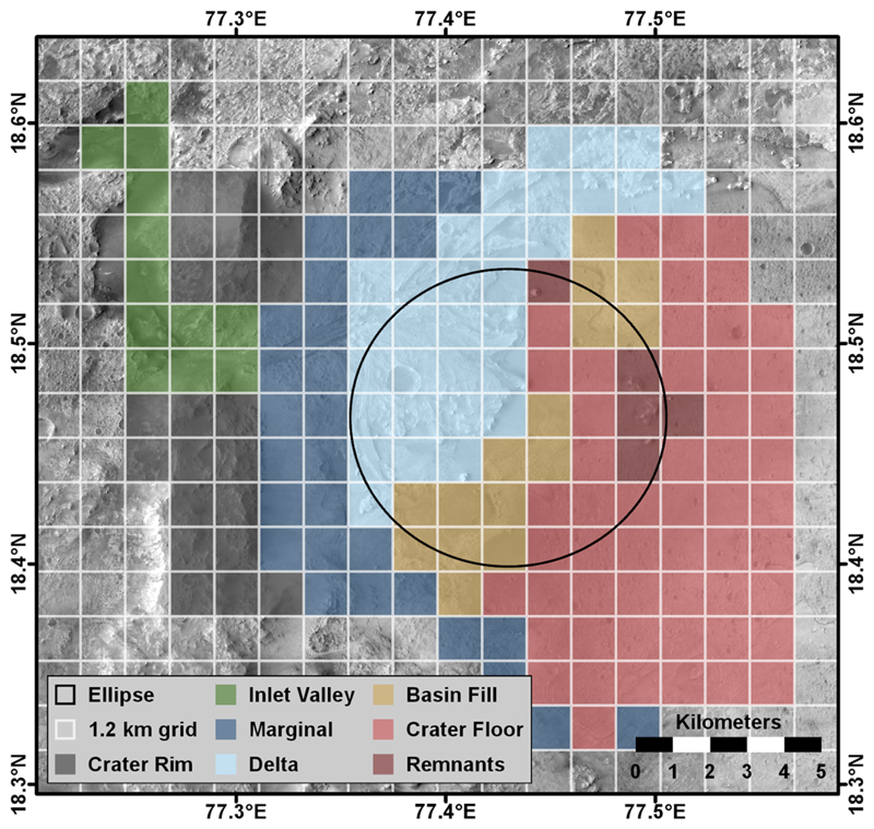
Fig. 3.
Map of the 1.2 km by 1.2 km quadrangles mapped by the Mars 2020 Science Team color-coded by geographic areas that correspond to the team’s mapping groups. The extent of this map corresponds to the area of greatest scientific interest to the Mars 2020 Science Team and where high-resolution HiRISE image data were available

