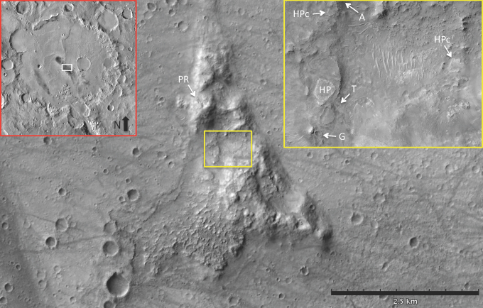
FIG. 1.
Context of the Columbia Hills in Gusev crater. Red-lined inset image depicts the ∼160 km diameter Gusev crater in a mosaic of THEMIS VIS images. The white rectangle (centered at 175.5° E, 14.6° S) is the location of the Columbia Hills shown in the main image, which is cropped from CTX B01_010098_1653_XI_14S184W. Basaltic lava flows have embayed the terrains of the Columbia Hills, implying that they are older than the flows. PR indicates Paso Robles S-rich soil. Yellow rectangle represents the yellow-lined inset image of the Inner Basin (cropped from HiRISE PSP_001513_1655_RED), which contains the Home Plate feature (HP) and two candidates for other Home Plate-like deposits (HPc), and the candidate volcanic vent feature called Goddard (G). Other S-rich soils are indicated at A for Arad and T for Tyrone. CTX, Context Camera; HiRISE, High-Resolution Imaging Science Experiment; THEMIS VIS, Thermal Emission Imaging System Visible Imaging System.

