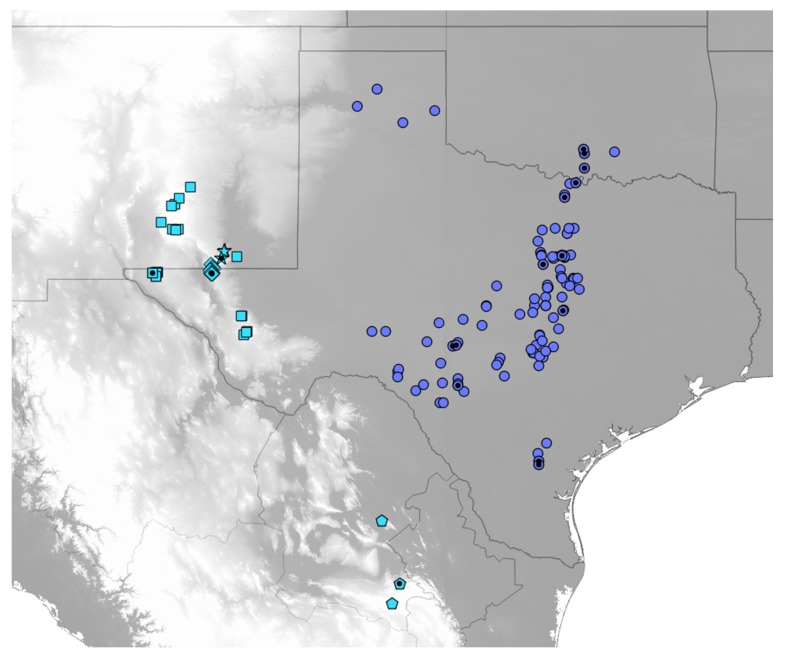
Figure 2.
Map of localities for Cicindelidia politula (see Table S1 for data). Classically defined subspecies are as follows, circles = C. p. politula, squares = C. p. barbaraannae, stars = C. p. viridimonticola, diamonds = C. p. petrophila, pentagons = C. p. laetipennis. Black dots indicate sampling localities for genetic data used in the present analyses. Blue-grey localities represent the nominate C. politula clade, recovered in the mtDNA genealogy (Figure 3A,B) and all genomic analyses (Figure 4 and Figure 5). Sky blue localities represent the C. laetipennis (new combination) clade, also recovered in all genetic analyses (Figure 3, Figure 4 and Figure 5). The two clades are ecologically differentiated, with significantly different adult phenologies (Figure 6). Grey map shading indicates topography, with lighter greys indicating higher elevation. All C. politula localities occur from <100 to 1050 m; all C. laetipennis localities occur from 1100 to 2600 m. Localities georeferenced in Google Earth Pro 7.3 and exported to QGIS 2.14 (http://qgis.osgeo.org).

