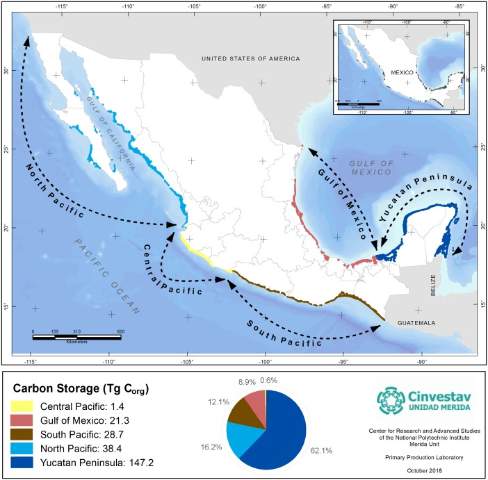
Figure 4. Mangroves Corg stocks by geographic regions of Mexico.
Data represent the total mangroves pool resulting from the cover extent and regional geographic differences in Corg stocks per unit of area. Data units are in Teragrams (1Tg = 1,000,000 Mg). Geographic Coordinate System: WGS 84. Reference cartography of geographic regions and mangrove extent, from INEGI (2011) and CONABIO (2009).

