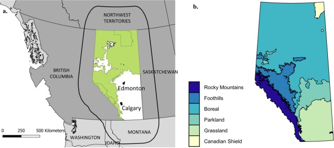
Figure 6.
(a) Map of the study area encompassing the province of Alberta and neighbouring Canadian Provinces and Territory and US States intersecting with the buffer area (rounded black line surrounding Alberta) around the province. Are represented the forest- (green) and agriculture-dominated (white) areas in Alberta, for which H values were allowed to be different for each human-footprint category. (b) Delineation of the main natural eco-regions in Alberta.

