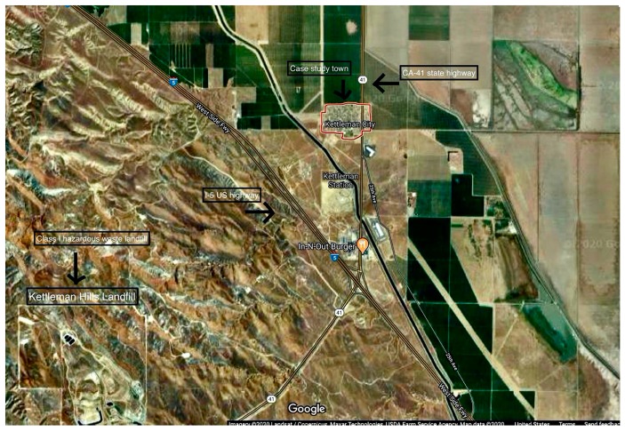
Figure 1.
Satellite imagery of Kettleman City showing the community, two intersecting highways surrounded by agricultural land and hazardous waste landfill, Kettleman Hills (imagery from Landsat/Copernicus, Mazar Technologies, U.S. Department of Agriculture Farm Service Agency (2020) accessed via Google Maps at a scale of 2000 feet).

