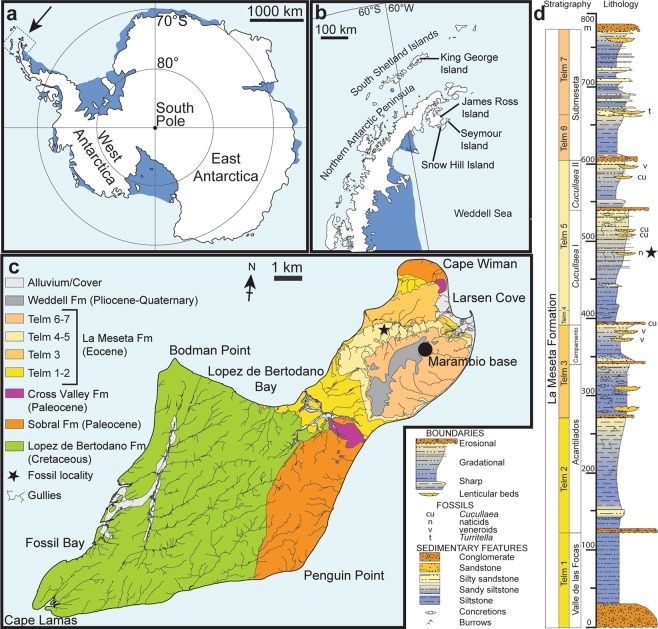
Figure 1.
Maps and stratigraphic column of the studied area and succession. (a) Map of Antarctica showing the location of the study area. (b) Map of the northern Antarctic Peninsula showing the location of Seymour Island. (c) Geological sketch map of Seymour Island, showing the position of the fossil locality (asterisk). (d) Stratigraphic column of the La Meseta Formation on Seymour Island (from11) showing the position of the fossil locality (asterisk). Redrawn from13.

