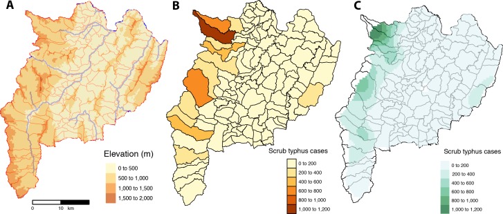
Fig 6.
Chiangrai province with: (A) the geography with elevation, main rivers and sub-district boundaries; (B) scrub typhus cases from 2003–2018 per sub-district; and (C) interpolation of scrub typhus cases at sub-district level by kriging using semi-variogram based on the centroids of geographical coordinates of each sub-district [created using tmap and tmaptools in R software–R Core Team 2018 [38–40]].

