
Figure 9.
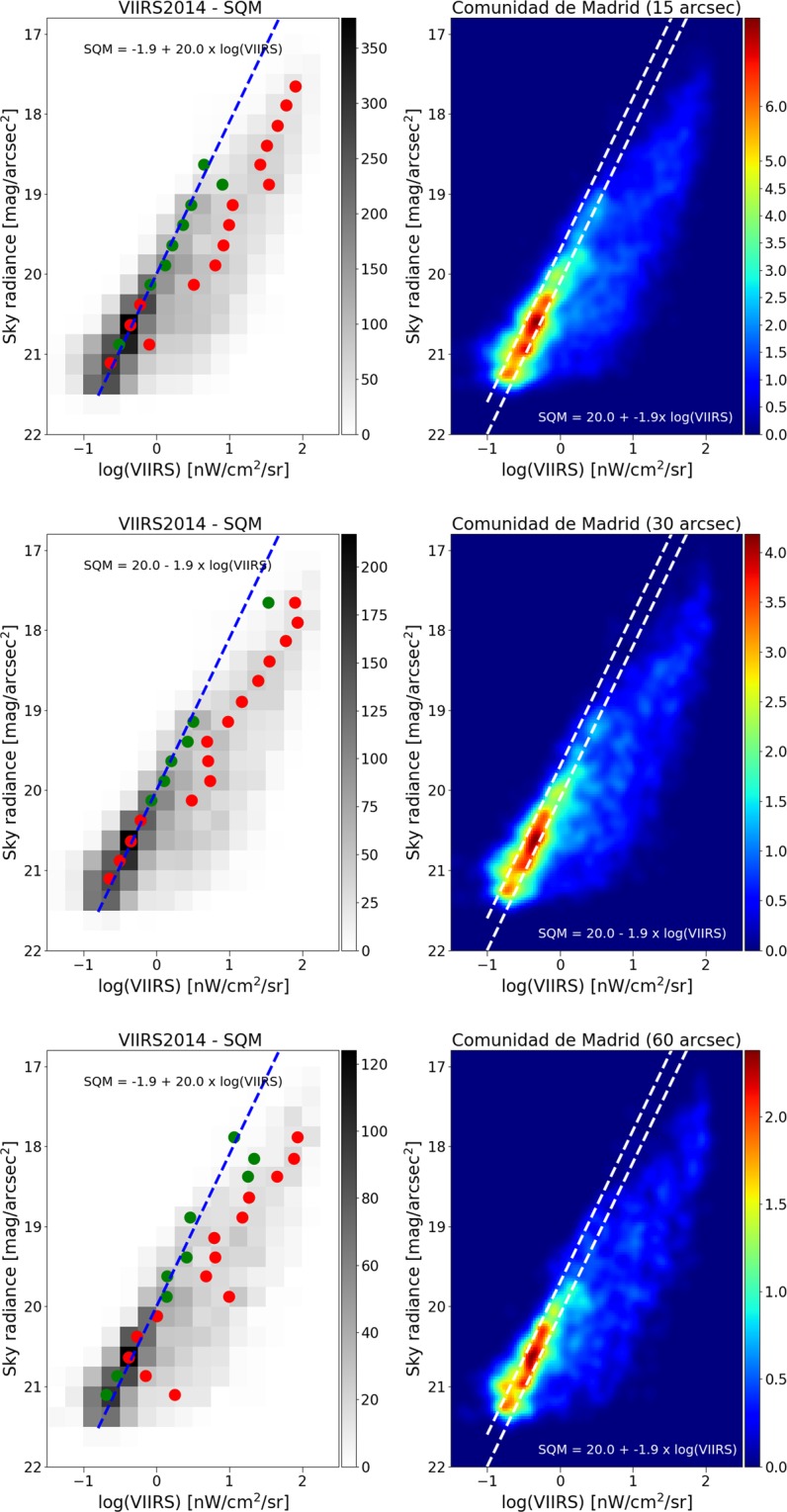
Relationship between sky brightness measured on the ground and satellite radiance observation for different sizes of pixel agglomeration for the VIIRS data. In the top plots, the VIIRS image data has been averaged over a pixel size of 15″ (arcseconds), in the middle plots 30″, and in the bottom plots 60″. In all cases, the relationship is strongest using the high resolution data. In the left plots, the green circle represents the dimmer Gaussian peak, and the red circles the brighter Gaussian peak. The right hand plots show the same result using a non-binned color coded density plot with a Gaussian filter. The two dashed lines have the same slope as the blue fit, and are shown for comparison purposes.