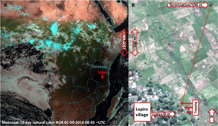
Fig. 1. Views from above.

(A) The pan-African annular eclipse on 1 September 2016, as seen at 11:45 local time from the geostationary Meteosat-10 orbiting at an altitude of 35,786 km. The location of the lidar is indicated with an arrow. (B) A close-up aerial view of the agricultural patches and the periphery of Lupiro village with the lidar transect indicated by the red line.
