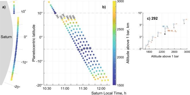
Figure 1.
Saturn’s ionosphere spatial coverage map for orbits 288–292 and the Final Plunge (293), as seen from the dawn direction (a, to scale with Saturn shown in grey) and in latitude versus local time (b). Dots mark the RPWS/LP sweeps, black circles mark the closest approach for respective orbits and the altitude is colour-coded. Panel c: Magnetic field (B) direction for this region on example of orbit 292 () as well as direction of dayside equatorial Pedersen current (in blue, parallel to electric field , eastward or westward) together with the direction of equatorial Hall current (in red, , upward or downward) that completes the orthogonal right-hand system. Note that every second datapoint in panel c has been omitted to reduce clutter.

