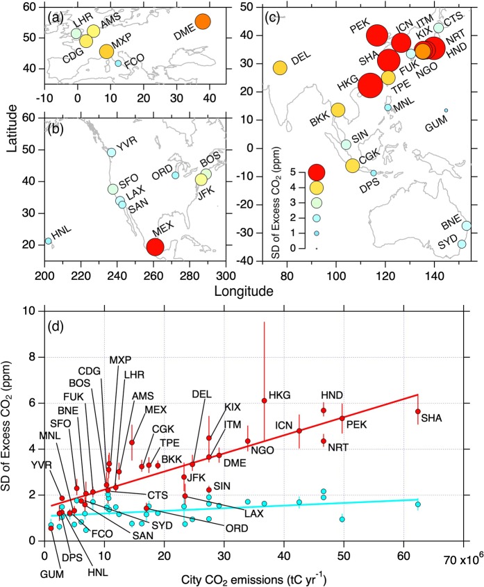
Figure 3.
Variability of CO2 enhancements over cities worldwide. (a–c), Maps of the SD values at 1.0–1.5 km altitudes. Size and color of the circles indicate magnitude of the SD (see the legend in panel c). (d) Relationship of the SD at 1.0–1.5 km (red) and 4.0–4.5 km (light blue) altitude bins with city CO2 emissions based on the ODIAC dataset26,27. Solid lines are least square fits to the data at respective altitude bins. Airport codes are indicated for the data from 1.0–1.5 km. The error bars represent range of the SD calculated by a Bootstrap method (N = 1000).

