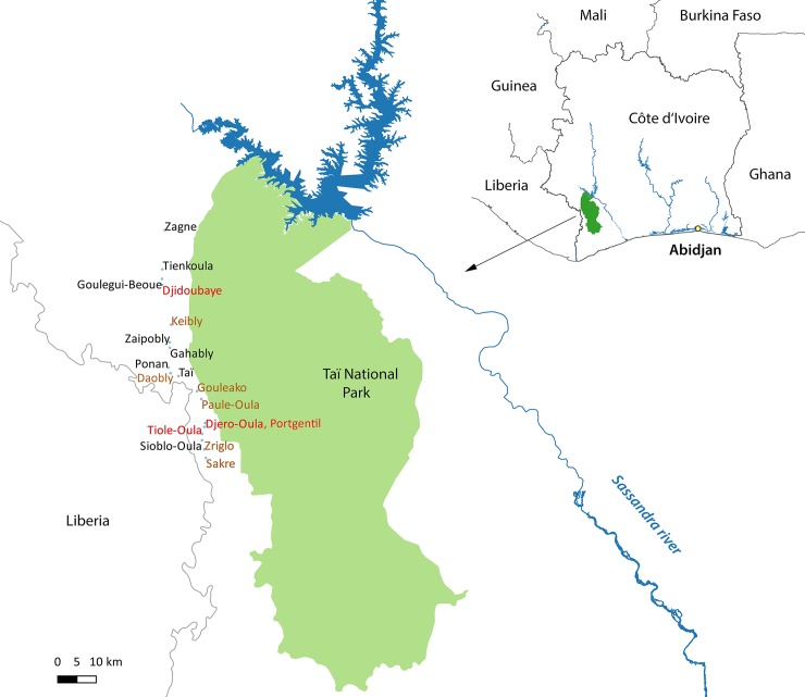
Fig 1. Study area at the border to Taï National Park.
Taï National Park is located in the south-west of Côte d’Ivoire near the Liberian border. Participants from one town and 17 villages were included in the study. All sampling sites are located in similar proximity to the National Park, connected by a minor road. Villages were color coded by level of Bcbva seropositivity: black font, Bcbva seropositivity 0–10%; brown font, Bcbva seropositivity > 10%– 15%; red font, Bcbva seropositivity > 15%. The map has been created by the authors of the manuscript with the freely available software QGIS and edited with Adobe Photoshop. Shape files for Africa were freely available at http://maplibrary.org/library/index.htm.

