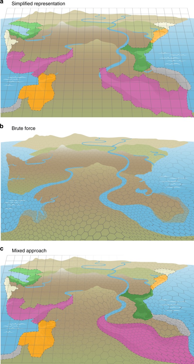
Fig. 5. Representing coastal interfaces in Earth system models.
a Perhaps the simplest approach would be to classify coastal interfaces based on a series of functional types for their main features (i.e., different types of tidal rivers, estuaries, intertidal ecosystems, and shoreline ecosystems; Fig. 2). Process parameterizations derived from synthesized data would be applied to the fraction of a pixel occupied by each feature rather than the current state of the art, which assigns some fraction of coastal pixels as land and some fraction as ocean. b The most sophisticated approach would be to couple high-resolution regional coastal interface models with coarser resolution Earth system models using a variable pixel size (i.e., Voronoi mesh). c Perhaps the most feasible and robust approach would be a combination of the two, whereby existing or strategically developed high-resolution models are coupled, and classifications of functional types are applied to systems where data required for high-resolution models are not available.

