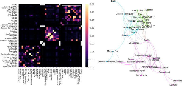
Fig. 7.
Left: Normalized inter-regional mobility computed during the 2nd of March. Regions are ordered according to their community membership detected with the Louvain algorithm. The three white diagonal squares indicate major communities corresponding to the southern, centre-northern and western part of the metropolitan area. Right: Topological representation of the major communities using the Yifan Hu Multilevel layout algorithm as implemented in Gephi.

