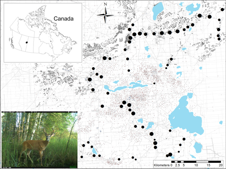
Figure 1.
White-tailed deer occurrence was surveyed at 62 camera sites (large block dots, scaled to the relative number of observations over three years) in the boreal forest of northeast Alberta, Canada. Anthropogenic footprint is extensively and intensively imposed on this landscape, including forest harvesting cutblocks (grey polygons), well sites (square dots), seismic lines (grey), and roads and trails (dark grey and colored lines). Lakes are in blue. Map was created in ArcGIS v.10 based on Alberta Biodiversity Monitoring Institute Human Footprint data 2010 (abmi.ca) and Government of Alberta water bodies data.

