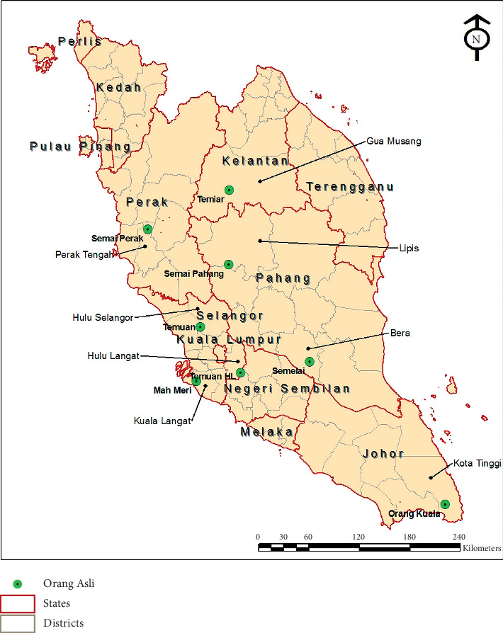
Figure 1.

Map of Peninsular Malaysia showing the locations of the Orang Asli villages surveyed in the study. The red line shows the state division, while the gray line shows the division of districts in each state. The Orang Asli villages are indicated with green bubbles.
