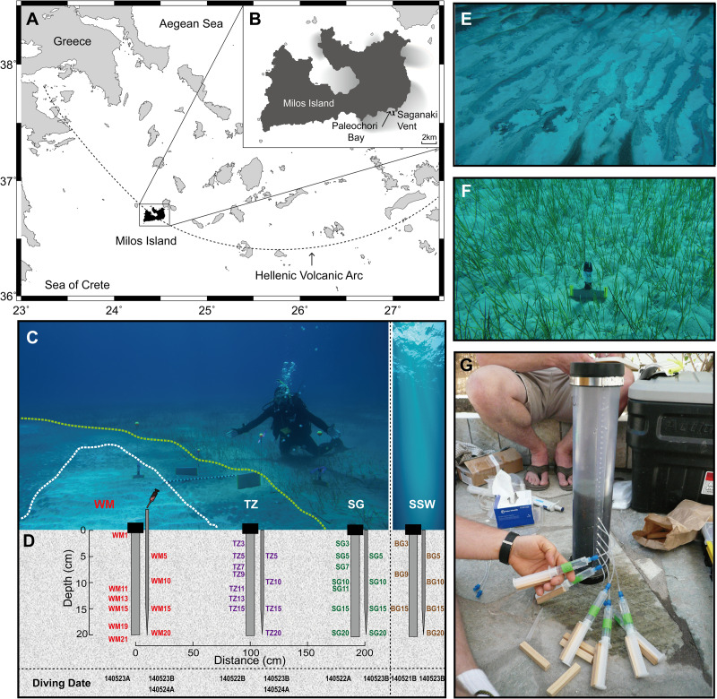
Fig 1. Site map.
(A) and (B) Location of the Saganaki diffuse vent in Paleochori Bay (~300 m offshore, 12 m water depth). (C) Photograph of Saganaki showing three of the biogeographic zones: white mat (WM), transition zone (TZ), and seagrass area (SG). (D) Schematic of sampling methods (push cores and long pipettes indicating the position and depth (in cm) of samples collected for geochemistry and sequencing analysis. (E) Photograph of white mat area. (F) Photograph of seagrass area. (G) Photograph of porewater sampling from sediment cores using rhizons.

