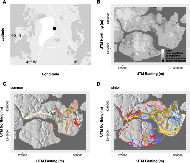
Fig. 1.
a Map indicating the study area (black rectangle) in northeast Greenland (white). b Map of the study area in detail (WGS 84, UTM zone 27), showing the distribution of landcover types (note that in the statistical models, lakes, non-vegetated and bare ground were pooled to ‘bare ground’). For the distribution of remaining static covariates, see Additional file 1: Fig. S1. c Muskox tracks during the snow-free summer and d snow-covered winter period across years, colour-coded by animal ID (within season). For an overview of muskox observations per season and year, see Additional file 1: Figs. S2-S3

