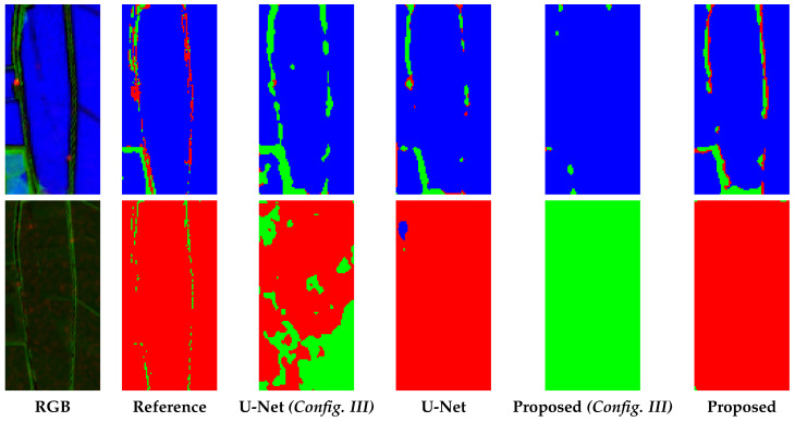
Figure 8.
Zoomed details of segmentation results. In the first column, a false colour images (R: VH, G: NDVI, B: MNDWI) is shown; in the other columns, the segmentation maps obtained with the methods under comparison are depicted. In all the segmentation maps green, red and blue pixels represent Vegetation, Bare Soil and Water, respectively. With (Config. III) we consider the dual polarization configuration both for the U-Net and the proposed W-Net.

