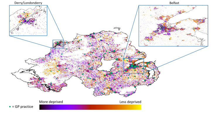
Figure 1.
Choropleth map of Northern Ireland with each postcode plotted as a coloured point on the MAP, and associated multiple deprivation index (based on small areas) as dot colour (see key). Locations of GP practices are highlighted with a green dot. Zoomed views of Northern Ireland's two cities (Derry/Londonderry and Belfast) are also shown. GP, general practitioner.

