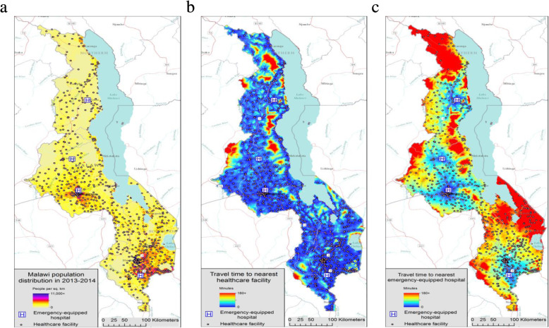
Fig. 2.
Malawi population distribution and travel times to the nearest health facility and emergency-equipped hospital, 2013-2014. a Map 1: Malawi population distribution in 2013-2014; b Map 2: Estimated population travel time (minutes) to the nearest health care facility in Malawi in 2013-2014; c Map 3: Estimated population travel time (minutes) to the nearest emergency-equipped hospital in Malawi in 2013-2014. Maps for this study were produced by Malaria Atlas Project, University of Oxford. The World Reference Overlay (data sources: ESRI, Garmin, USGS, NPS) was used as the base map

