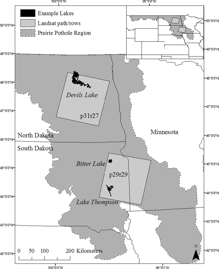
Fig. 1.
Location of study sites and three specific lakes (i.e., Devils Lake, Bitter Lake, Lake Thompson) analyzed within the Prairie Pothole Region of the United States. The study area for the lake-scale analysis was defined as the maximum lake extent observed over the time series (shown). Landscape scale analysis was restricted to the two Landsat path/rows shown, while a third Landsat path/row time series (p31/r26, not shown) was used to map the northern extent of the maximum Devils Lake extent

