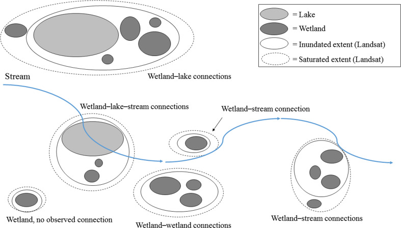
Fig. 3.
A simplified schematic showing the different types of surface-water connections identified in the landscape-scale analysis. Differences in connections between inundated and saturated thresholds are interpreted as differences in wetlands subsumed (connected using inundated extent) versus merged (connected only under the saturated extent)

