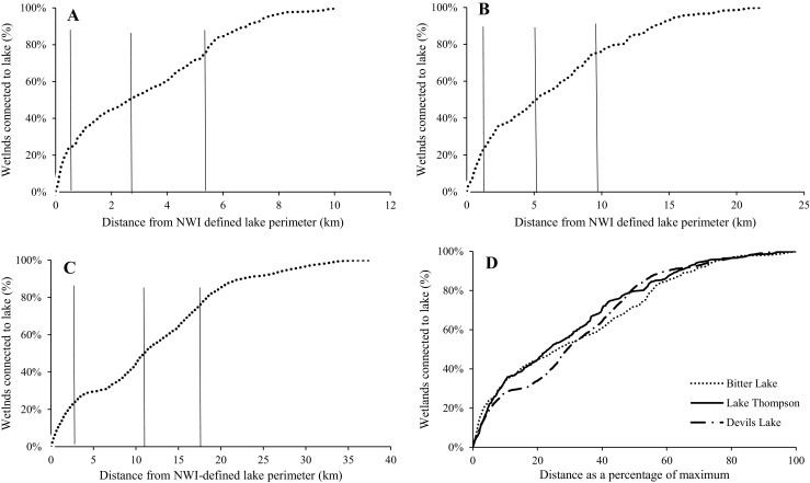
Fig. 8.

The cumulative distribution of wetlands (using the saturated threshold) showing surface-water connections with a) Bitter Lake, b) Lake Thompson, and c) Devils Lake, as a function of distance from the NWI-defined lake perimeter. Quartiles show the distance at which 25, 50 and 75 % of all wetlands have become part of the lake complex to (solid vertical lines). d) The normalized distribution of wetlands showing surface-water connections with each lake as a function of distance from NWI-defined lake perimeter
