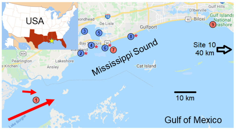
Figure 1.
Map showing the sampling locations (circles) in the Mississippi Sound with direction of freshwater inflows from the Bonnet Carré Spillway and the Pearl River (red arrows). Sample site numbers increase from west to east. Sampling sites 2, 4, 6, and 8 (red stars) were at oyster reefs. Red circles represent sites where samples were collected by the Mississippi Department of Environmental Quality, and blue circles sites where samples were collected by the University of Mississippi. Site 10 is off the map, about 40 km to the east in Alabama waters. The inset shows the general study location within the USA.

