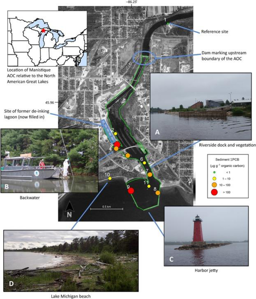
Figure 1.
Manistique River and Harbor Area of Concern (AOC). Map background shows an overview of the study area at the mouth of the Manistique River, with the locations of sampling sites and other features of interest; sampling sites are shown as colored symbols representing the annual site mean total organic carbon-normalized total polychlorinated biphenyl (ΣPCB) concentration in sediments averaged over 3 yr of sampling (2011–2013), that is, the grand means. The green outline indicates the designated AOC boundary. Photos show examples of the major riparian habitat types present in or near the AOC that were sampled in the present study: river (A), backwater (B), harbor (C), and lake shore (D). Map data: Google, Digital Globe, Landsat, USDA Farm Service Agency; software: Kahle and Wickham 70. Photo credit: D. Walters.

