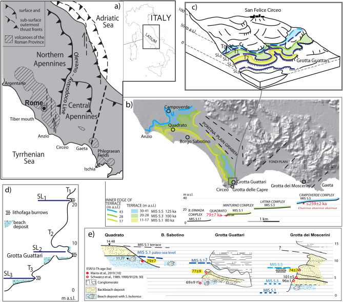
Figure 1.
(a) Structural sketch of central Italy. (b) Digital Elevation Map (DEM) image of the southern Latium coast showing the suite of three marine terraces described in10. Background DEM: TINITALY/01 square WA 6,570, used with permission by the Istituto Nazionale di Geofisica e Vulcanologia, Rome. The cross-section shows the correlation among the marine terraces reconstructed by19 and those identified by10; bio- and geochronologic constraints (in red) allowing for correlation with MIS 5.5, MIS 5.3 and MIS 5.1 are also reported. (c) Coastlines (SL) and related terraces (T) reconstructed at Circeo promontory in the surrounding of Grotta Guattari by21–23. (d) sea-level indicators represented by tidal notches, lithophaga burrows and biodetritic beach deposits. (e) Correlation among different sea-level markers ranging 10–8 m a.s.l., represented by the terraced deposit of the Minturno complex in Quadrato, and by the beach to backbeach sedimentary filling of Grotta Guattari and Grotta dei Moscerini; the three consistent ESR/U-Th ages suggesting correlation with MIS 5.1 are shown. All drawings by F. Marra.

