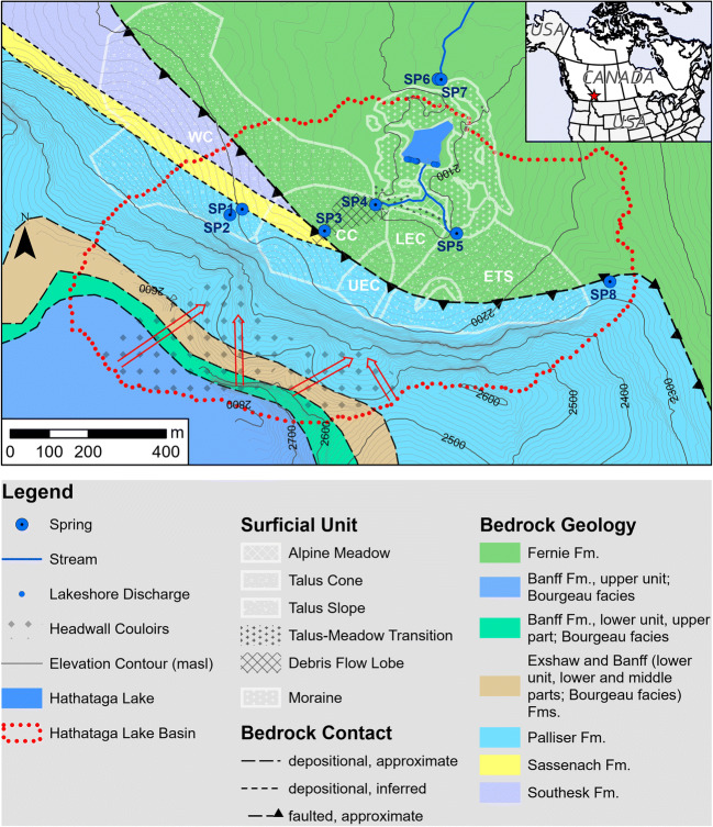
Fig. 1.
Map of Hathataga Lake Basin near Fortress Mountain showing bedrock lithology, surficial geology, and hydrology. White lettering notes the abbreviated names of the West Cone (WC), Central Cone (CC), Upper East Cone (UEC), Lower East Cone (LEC), and Eastern Talus Slope (ETS), and the red arrows denote the drainage direction within the headwall couloirs. Red star in the inset map shows the location of the site within Canada. Bedrock spatial data from McMechan (2012)

