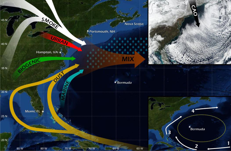
Figure 1.
Map of the extended Western North Atlantic Ocean (WNAO) with major features shown such as key sources of gases and aerosols, an example of a cold air outbreak (CAO), and ocean currents that transport water around the Atlantic Ocean to form the North Atlantic gyre, within which lies Bermuda and the Sargasso Sea (1 = North Equatorial Current, 2 = Antilles Current, 3 = Gulf Stream, 4 = North Atlantic Drift). This study focuses on both the spatial domain of WNAO defined here as the oceanic area bounded by 25–50°N and 60–85°W and North America’s East Coast. The yellow oval in the lower right panel represents the Sargasso Sea. The CAO shown in the top right panel is a NASA Worldview image (https://worldview.earthdata.nasa.gov) from 22 January 2019.

