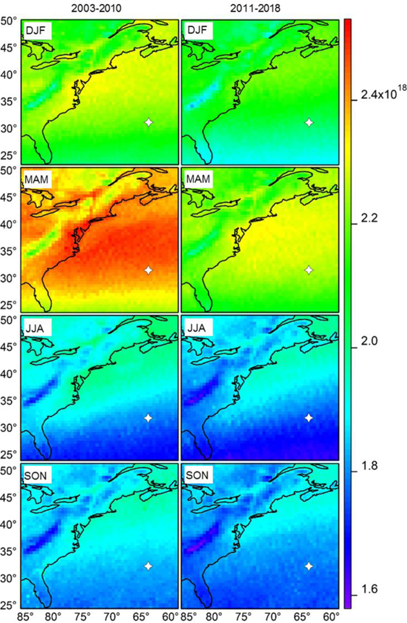
Figure 4.
Seasonal maps of columnar carbon monoxide (CO) concentration (molecules cm−2) from the Atmospheric Infrared Sounder (AIRS) over the extended WNAO region, including the eastern part of North America, categorized into two time periods (2003 – 2010 and 2011 – 2018). We specifically rely on the AIRS/Aqua L2 Standard Physical Retrieval (AIRS-only) V006 product at 50 × 50 km resolution (https://search.earthdata.nasa.gov). The gray marker represents Bermuda.

