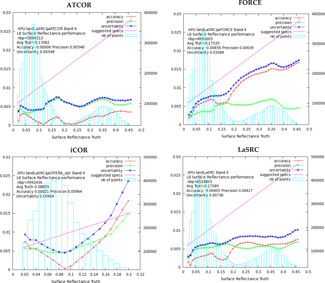
Figure 2.

The accuracy (red line), precision (green line), and uncertainty (blue line) as computed in bins (blue bars) for OLI Band 4 (Red). The total number of pixels (nbp) used in the computations is given also in the plot. The magenta line represents the theoretical SR reference for Landsat SR (0.005+0.05×ϱ).
