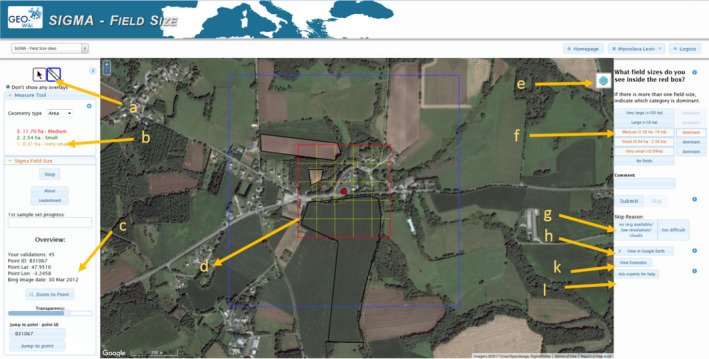
Figure 2.

Screenshot of the Geo‐Wiki interface showing: (a) the area measuring tool; (b) the actual field sizes delineated and measured using (a); (c) the cumulative work done by a participant; (d) the main classification area, gridded; (e) the button to switch between different background imagery, that is, Google or Bing; (f) buttons to select the field size categories: very large, large, medium, small, very small, or no fields; (g) possible reasons to skip the current location; (h) a button to display location in Google Earth; (k) examples of field size estimation for training; (l) a button to ask experts for help. Source of imagery: Google Maps [Colour figure can be viewed at wileyonlinelibrary.com]
