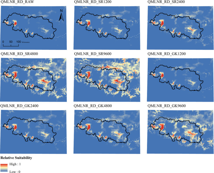
FIGURE 3.

Uncorrected and corrected ensembles in Qomolangma National Nature Reserve, using real occurrence data (QMLNR_RD). RAW = uncorrected model. SR = Spatial Rarefaction, followed by radius in meters. GK = Gaussian Kernel, followed by radius in meters. Dashed white lines represent National Borders. Inland water layers have been overlaid on top, using the color scheme indicating the lowest suitability
