
Figure 1.
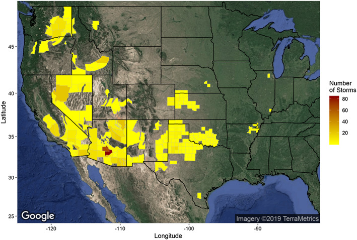
National Weather Service forecast zones (WFZ) colored by the number of reported dust storms (1996–2017) observed. Zones without dust storms are not colored. Satellite imagery was downloaded from Google Maps (Google, Inc) on 14 March 2019 and mapped using the ggmap package in R.