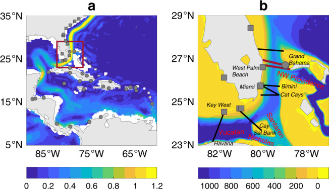
Fig. 1. Florida Current and study region.

a Gray squares (circles) are locations of tide gauges in the southeastern USA (Caribbean). Shading is mean ocean surface current speed (m s−1) from surface-drifter data97. Red box is area shown in b. b Details of Florida Straits. Shading is ocean depth (m). Red bold (black oblique) font indicates ocean channels (land locations) mentioned in the text. Thick red lines are locations of submarine-cable measurements1–4. Thin black lines are locations of in situ measurements from past studies18–21.
