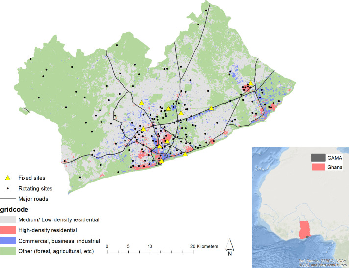
Figure 1.
The Greater Accra Metropolitan Area (GAMA) and locations of the fixed and computer-generated (sampled) rotating sites. The road network data are from OpenStreetMap and the background land cover shapefile is from the World Bank (2014). The inset shows background maps of Africa and Ghana (ESRI (Environmental Systems Research Institute)), along with the GAMA boundary from Ghana Statistical Service. High-density residential indicates neighbourhoods with small, crowded, irregular buildings and narrow unidentifiable unpaved roads such as in shanty towns and slums. Medium/low-density residential indicates neighbourhoods with small regular planned buildings and indicate formal residential areas. Commercial/ business/ industrial indicates neighbourhoods with large buildings that can be used for commercial, industrial, office or warehouse purposes. Other indicates areas with large spaces of vegetation (eg, dense forest), barren land (eg, sand, soil) or water bodies.

