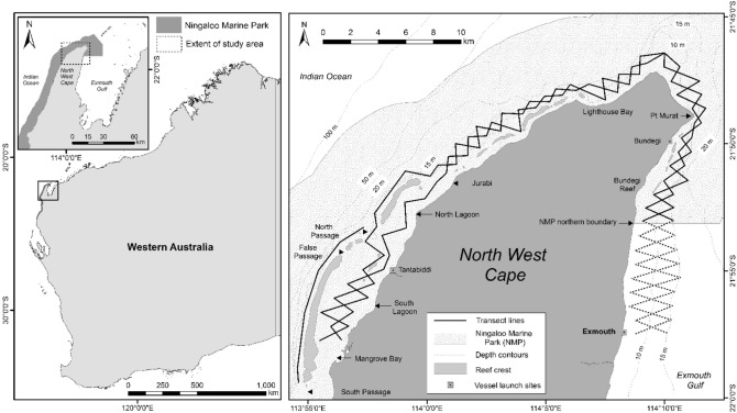
Figure 1.
Left: Map of Western Australia, indicating extent of Ningaloo Marine Park, location of North West Cape (NWC), and extent of study area. Right: Map of the NWC study site, including northern Ningaloo Marine Park (NMP) boundary, location names, depth contours, vessel launch sites (Tantabiddi, Bundegi, and Exmouth boat ramps) and opposing zig-zag line transect sampling design. Dotted transect lines indicate the area south of the NMP boundary that were excluded from analyses. Figure created in ArcMap 10.3.1 in ESRI’s ArcGIS© (ESRI, Redlands, California; https://www.esri.com/en-us/arcgis).

