
Figure 3.
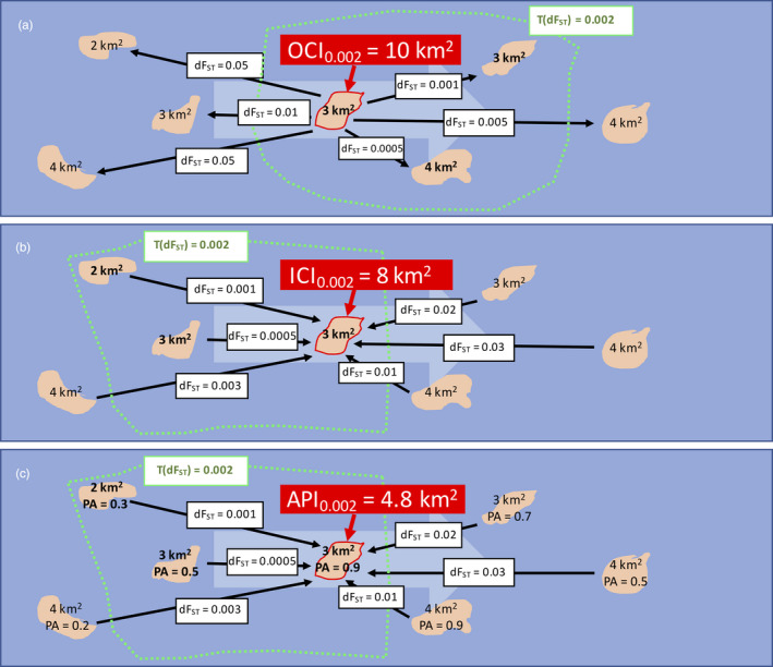
Calculation of connectivity and adaptive potential indices. The three maps display a hypothetical seascape with seven reefs (in rose) of different extent and connected by sea current flowing from left to right (large light blue arrow). On each map, a different index is calculated for the same focal reef (highlighted in red): (a) outbound connectivity index (OCI), (b) inbound connectivity index (ICI) and (c) adaptive potential index (API). The black arrows display the estimated directional genetic separation (dFST) for corals travelling from (a) and towards (b, c) the focal reef. The calculation of the indices requires that a threshold value for dFst is set (in this example, T(dFst)=0.002, the green border) in order to define the reefs neighbouring the focal one. OCI (a) represents the total area (in km2) of neighbouring reefs (destinations) that can be reached from the focal reef (departure). ICI (b) represents the total area of neighbouring reefs (departures) that can reach the focal reef (destination). API (c) is a special case of ICI, where the area of the neighbouring reefs is weighted by their probability of presence of adapted genotypes (PA)