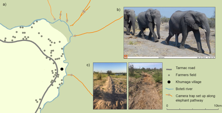
Figure 3.
(a) Locations of sampled elephant pathways (orange lines) leading to the Boteti river during the course of the study. Dark green represents the MPNP protected area, and light green unprotected land, dominated by human activities, cattle and arable farming28. Aside from one functioning water hole, approximately 12 km northwest of the river, the river was the only permanent water source for wildlife in the area during this study. (b) Examples of images from camera traps (set to record video) of groups of elephants walking in a single file down the pathway. (c) Example images of elephant pathways in the MPNP.

