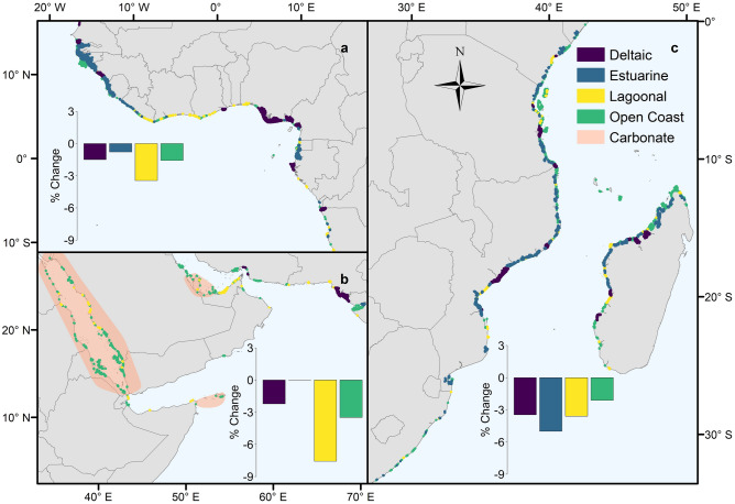
Figure 2.
Distribution of deltaic, estuarine, lagoonal and open coast mangrove types, and approximate extent of carbonate sedimentary settings in the (a) West and Central Africa, (b) Middle East and (c) East and Southern Africa regions. Bar charts represent the percentage change in area of the different types between 1996 and 2016 at the regional scale. Adapted from Worthington and Spalding38. The map was generated in ArcGIS Desktop version 10.6 software (https://desktop.arcgis.com/en/).

