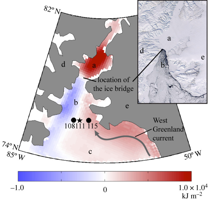
Figure 1.

Location of stations 108, 111 and 115 in northern Baffin Bay. The map shows the difference between the average cumulated SWR at the sea surface, expressed in kJ m−2, for years without the polynya (1990, 1993, 1995, 2007, 2009 and 2010) and the average climatological SWR (1979–2010). Blue and red colours represent either negative or positive anomalies. Northeastern Baffin Bay and Nares Strait upstream of the ice arch are regions of positive anomalies while western Smith Sound, along the Canadian coast downstream of the ice arch, shows a negative anomaly. Inset: A Moderate Resolution Imaging Spectroradiometer (MODIS) image of the open polynya on 23 April 2002. The ice bridge prevents sea ice from drifting in the polynya. (a) Kane Basin; (b) Smith Sound; (c) Baffin Bay; (d) Ellesmere Island, Canada; (e) Greenland. (Online version in colour.)
