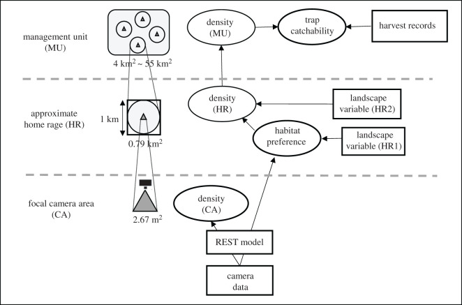
Figure 1.
General framework of our modelling procedure, which includes estimated parameters (ovals) and data (rectangles) at three different spatial scales (camera site, approximate home range and management unit). For landscape variables at the intermediate scale, two slightly different ones were obtained from land-use data, as habitat preference was estimated in a circle buffer with radius 500 m (HR1), while density was estimated in a 1 km grid scale (HR2). Note that this framework was applied to each month throughout the year.

