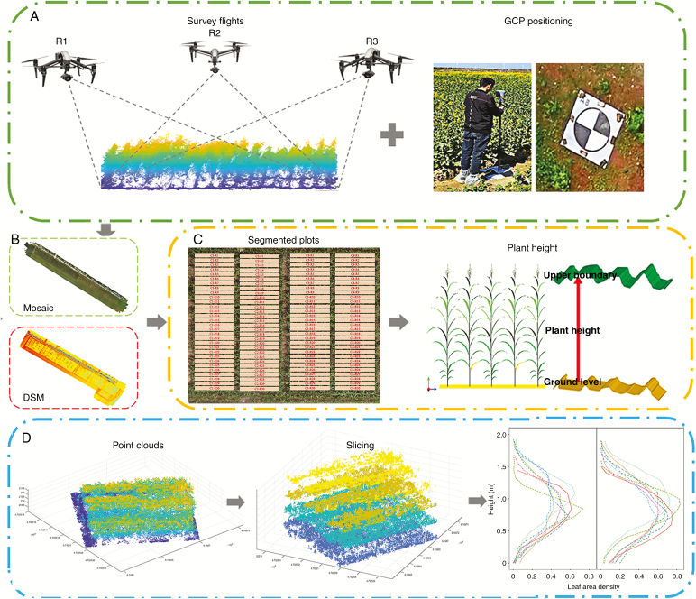
Fig. 1.
Phenotyping pipeline for estimation of plant height and LAI by the UAV platform. (A) The flow of acquisition of UAV images, (B) the process to generate the point cloud, orthomosaic map and digital surface model, (C) individual plot segmentation and the method of plant height calculation and (D) flow of slicing point clouds and estimation of leaf area density at different canopy layers.

