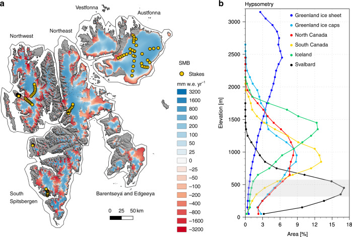
Fig. 1. Svalbard surface mass balance and hypsometry.
a Modelled surface mass balance (SMB) statistically downscaled to 500 m spatial resolution, averaged for the period 1958–2018. Orange dots locate the 101 stakes used for model evaluation (Supplementary Fig. 2a). The sectors of Svalbard evaluated in Supplementary Fig. 2b are also outlined. b Hypsometry of six Arctic ice masses: Svalbard (S0 Terreng DEM), Iceland (Arctic DEM), North and South Canadian Arctic Archipelago (Canadian DEM)24, Greenland ice sheet (GIMP DEM)41, Greenland peripheral glaciers and ice caps (GIMP DEM)23. The x-axis shows the glacier area in each 100 m elevation band as a fraction of the total ice area of that region (%).

