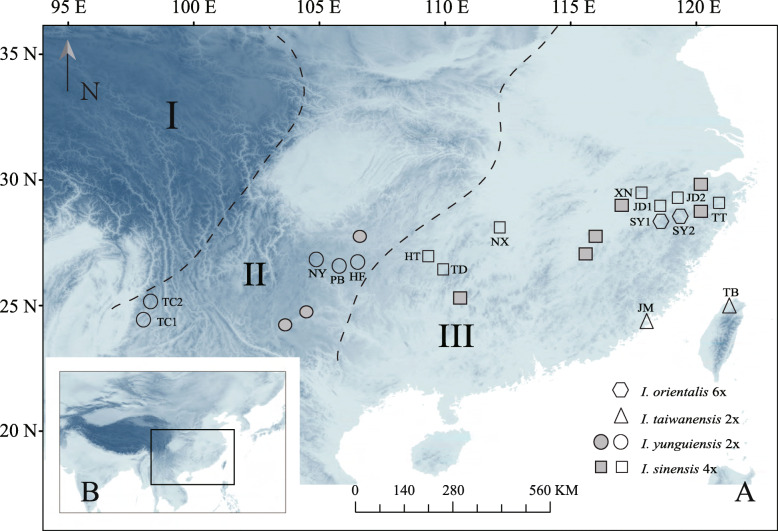
Fig. 1.
The map was download from WorldClim 1.4 (www.worldclim.org), and it is licensed under a Creative Commons Attribution-ShareAlike 4.0 International License (http://creativecommons.org/licenses/by-sa/4.0/). Geographical distributions of the sampled populations of Chinese Isoetes complex: hexagons, triangles, circles and squares are used to represent I. orientalis, I. taiwanensis, I. yunguiensis and I. sinensis respectively. The populations colored as grey are extinct. The dotted lines delimit the three distinct elevation stairs (elevation decreases from left to right) in China

