
Fig. 1. Spatial extent of Arctic tundra and locations of field and Landsat sample sites.
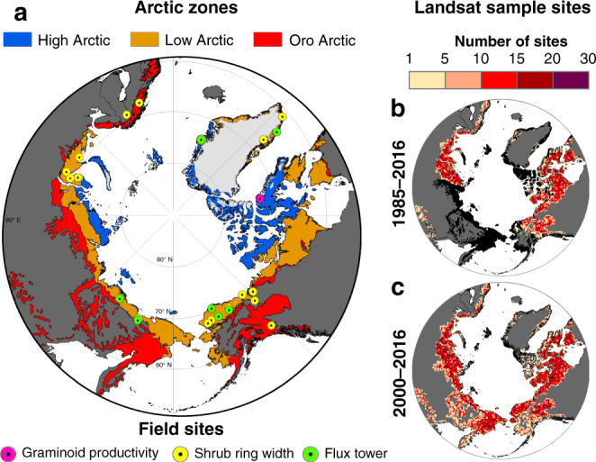
a The Arctic can be subdivided into the minimally vegetated High Arctic, moderately vegetated Low Arctic, and southern mountainous Oro Arctic. Landsat NDVImax was compared against three metrics of plant productivity measured at field sites around the Arctic. b, c Number of Landsat sampling sites within a 50 × 50 km2 grid cell that were used for assessing NDVImax trends and correlations with summer temperatures from 1985 to 2016 and 2000 to 2016. It was not possible to assess NDVImax trends or correlations in the eastern Eurasian Arctic from 1985 to 2016 owing to the lack of Landsat data prior to circa 2000. Arctic tundra without adequate data for Landsat assessment is shown in black. Projection: Lambert Azimuthal Equal Area.