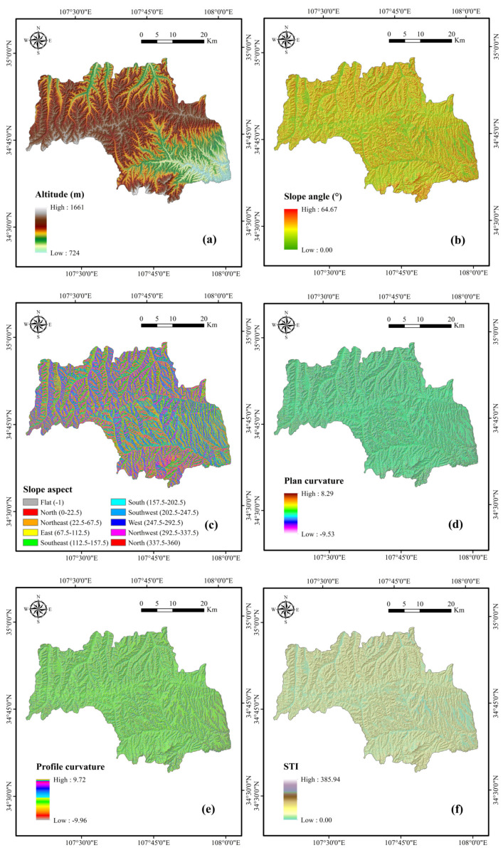
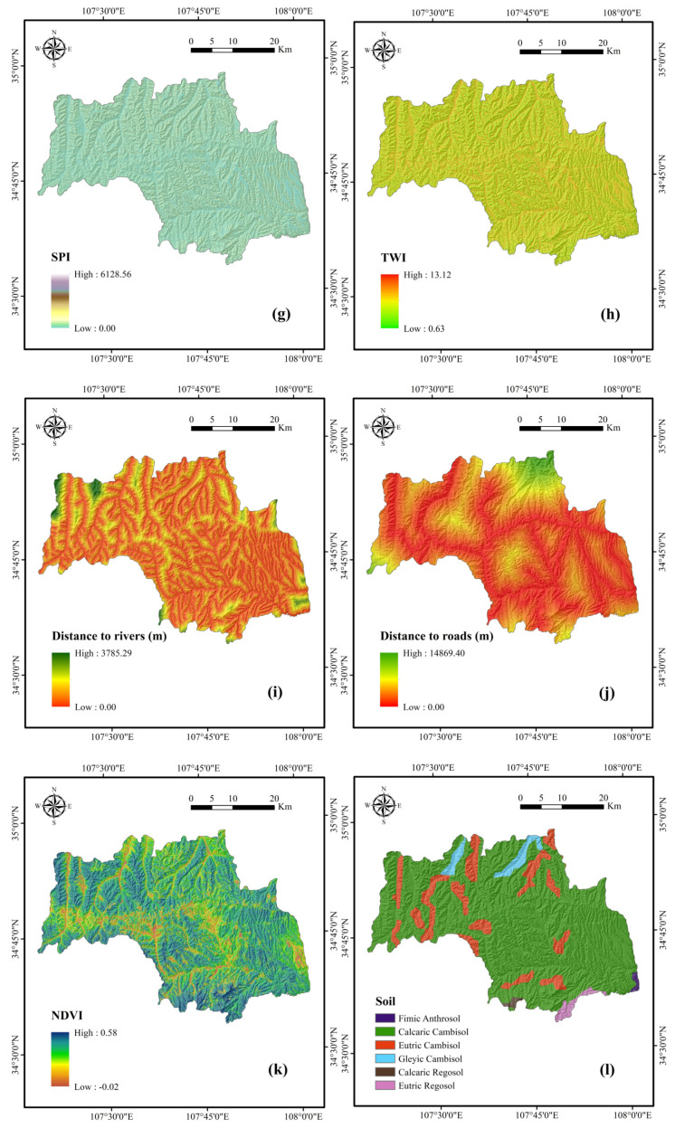
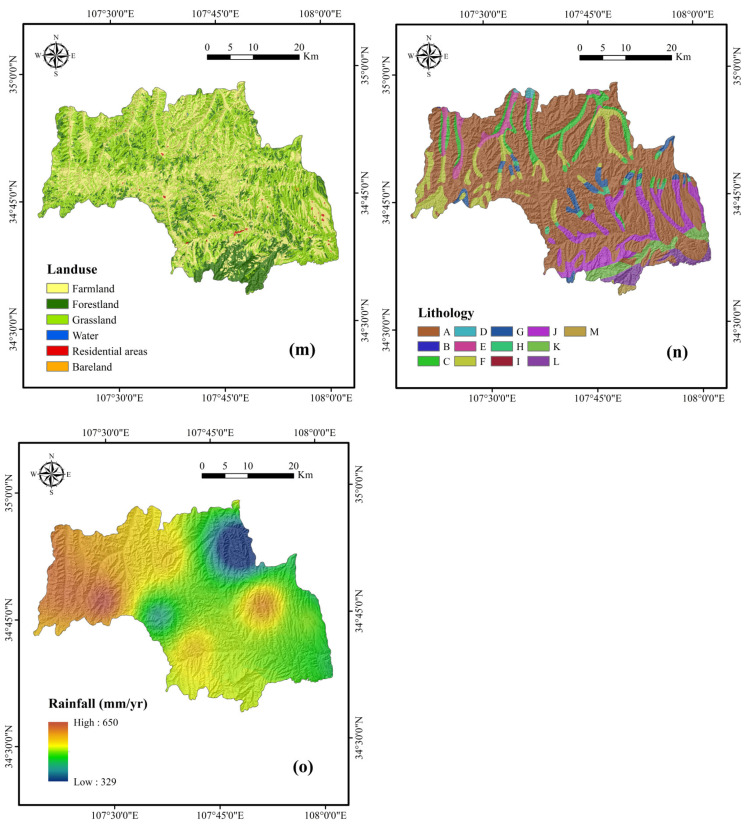
Figure 2.
Thematic maps of the study area: (a) altitude; (b) slope angle; (c) slope aspect; (d) plan curvature; (e) profile curvature; (f) sediment transport index (STI); (g) stream power index (SPI); (h) topographic wetness index (TWI); (i) distance to rivers; (j) distance to roads; (k) normalized difference vegetation index (NDVI); (l) soil; (m) land use; (n) lithology; (o) rainfall.


