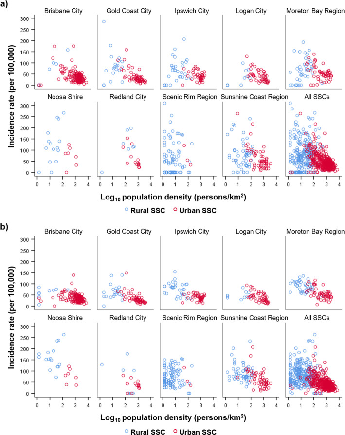
Fig. 5.
Mean annual RRV incidence of rural and urban State Suburb Codes (SSCs), 2001–2016. a raw incidence rates, and b smoothed incidence rates for the 757 SSCs of south east Queensland, shown according to the 9 Local Government Areas (LGAs) they are located within, and all SSCs combined. Rural and urban SSCs are indicated by blue and red circles, respectively. Two outlying SSCs (in Ipswich City and Noosa Shire) had incidence values beyond the scale shown here, but are listed in Additional file 4. See Fig. 1 for location of each LGA within the study area

