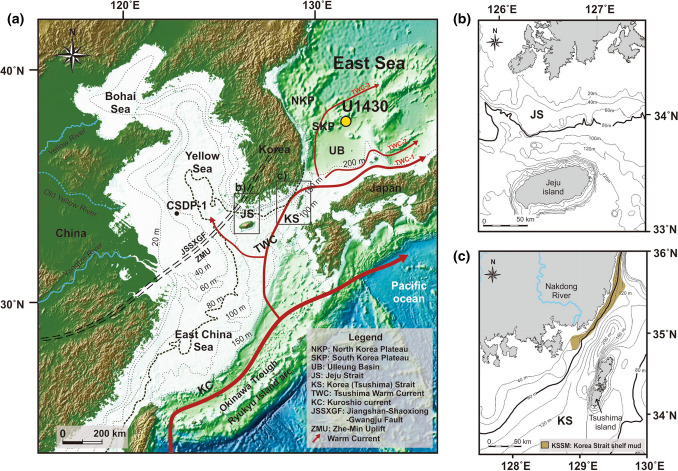
Figure 1.
Physiographic maps of the study area. (a) Map showing the U1430 core site, bathymetry, current system, faults, and uplift in the East Sea, Yellow Sea, East China Sea, and adjacent regions (modified from Tada et al.26 and Liu et al.48. (b) Bathymetry map of the Jeju Strait region. (c) Bathymetry map of the Korea (Tshushima) Strait region23. These maps were created using the software Generic Mapping Tools (https://www.generic-mapping-tools.org/download/)56.

